GridGIS Map Creator app

Description
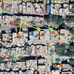
Mapping distribution networks with GPS coordinates
For efficient management of distribution networks, it is not only necessary to have an accurate and up-to-date knowledge of the topology of the Low Voltage network, but also to know where these electrical networks run.
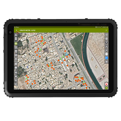
With the GridGIS Map Creator app it is possible to carry out, directly in the field, the mapping with GPS coordinates of LV and MV networks, overhead or underground, together with their different assets (SSs, poles, manholes…), as well as piping distribution networks.
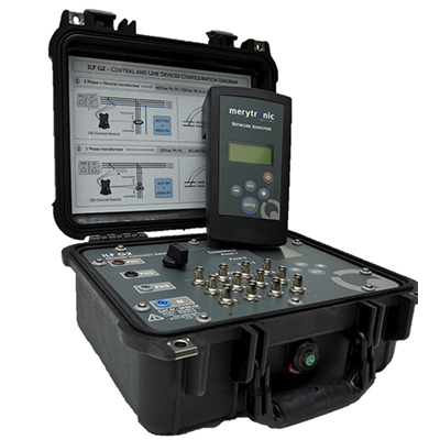
Specially designed to work with MRT-700 device, it speeds up field work, simplifies data transfer to the utility’s GIS system and avoids recording errors.
GridGIS Map Creator is designed by Ariadna Grid (Merytronic’s technological partner).
This solution is also valid for piping networks digitalisation.
Main features
- Register of Secondary Substation (SS) assets: SS, transformer, LV panel, feeder numbers, type of MV and LV cables, MV swichtgear.
- GPS record of each registered point: CT, CGP, pole, meter, meter centralisation…
- Map of the route with GPS coordinates.
- Images of the identified assets
- Metadata of each point captured, such as depth, signal level (mA)…
- Tracking of field work
- Bluetooth connection
- Export/Import in files compatible with GIS tools: GeoJSON, KMZ and Shapefile
- Data integration with the utility’s GIS system
Video
MEE2020: MRT-700 Demo with GridGIS Map Creator

Related products