GridGIS Map Creator app
Mapping distribution networks with GPS coordinates
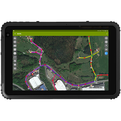
For efficient management of distribution networks, it is not only necessary to have an accurate and up-to-date knowledge of the topology of the Low Voltage network, but also to know where these electrical networks run.
With the GridGIS Map Creator app it is possible to carry out, directly in the field, the mapping with GPS coordinates of LV and MV networks, overhead or underground, together with their different assets (SSs, poles, manholes…), as well as piping distribution networks.
Specially designed to work with MRT-700 device, it speeds up field work, simplifies data transfer to the utility’s GIS system and avoids recording errors.
GridGIS Map Creator is designed by Ariadna Grid (Merytronic’s technological partner).
This solution is also valid for piping networks digitalisation.