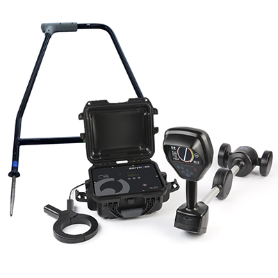
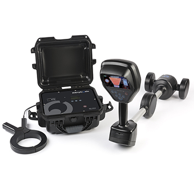
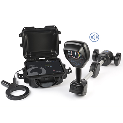
MRT-500

Description
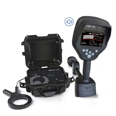
Underground cable and pipe locator
The MRT-500 device is an underground cable and pipe locator, which makes it possible to trace distribution networks quickly, easily and accurately.
- Energised Cables
- De-energised Cables
- Low Voltage, Medium Voltage and High Voltage Lines
- Metallic and non-metallic pipeline
Specially designed for contractors, maintenance departments, civil works, GIS, etc., to locate and trace the cables of their distribution networks. It is also valid for locating and tracing underground pipe networks.
In addition, thanks to its compatibility with the GridGIS D-twin digitisation app (developed by Ariadna Grid), it allows the underground network to be digitised accurately.
Main features
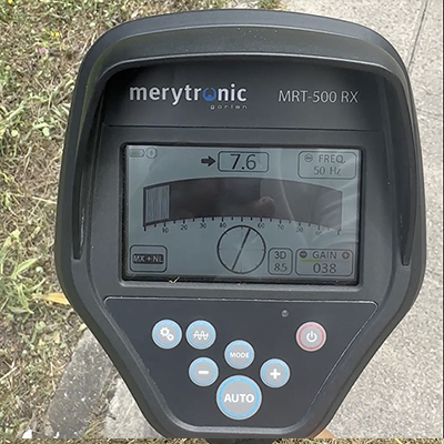
- Receiver with 5 Sensors, strategically distributed
- Visual and acoustic indication of cable/pipe
- Measurement of the depth and current amplitude
- Depth measurement accuracy (<3% up to 2m; <5% up to 10m)
- Detects 4 active and 2 passive frequencies
- Up to 10 mts depth
- Operation time >20h
- Transmitter with 10W of power, user-adjustable
- Correct performance > 10 km in length
- Rechargeable internal battery in both devices
Others applications
Underground piping networks maintenance (optional)
The MRT-500 device with its different accessories, allows to locate and to trace pipes, in an agile and effective way. It is suitable for both METALLIC and NON-METALLIC pipes, allowing maintenance teams to know exactly where the pipe they need to work on runs, before digging. Avoiding perforate the routes of other services
Metal Piping
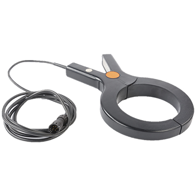
- Direct connection to any accessible point of the pipe
- No need for guides or probes
- CPS mode with polarity of the induced signal allows to see the direction of the current and to discriminate returns.
Non-metallic piping
- Specific guide and probe accessory pack for non-metallic piping
Electric distribution network digitisation (optional)
Once the network assets have been located, the next step in the digitisation of electrical networks is to know where the connection lines run between the different assets.
Merytronic has developed a complete solution, consisting of the MRT-500 device together with the GridGIS D-twin app. This solution makes it possible to locate and trace the network while recording the data in the digitisation app. Thanks to the app, existing data can be downloaded from the company’s GIS system on a map of the terrain, edited and expanded during field work and uploaded to the system once the work has been completed. This process is carried out in a simple way, thus avoiding transcription errors.
Piping networks digitalisation (optional)
The MRT-500 device and its digitalisation app GridGIS D-twin, help to carry out the digitalisation of distribution networks for Oil&Gas companies in an agile and efficient way. It is suitable for metallic and non-metallic pipes.
Thanks to the app, existing data can be downloaded from the company’s GIS system on a map of the terrain, edited and expanded during field work and uploaded to the system once the work has been completed. This process is carried out in a simple way, thus avoiding transcription errors.
There is an advanced version of the locator, the MRT-700, with more features and functionalities.
DOWNLOADS
Find more information about this and other solutions in our download area.